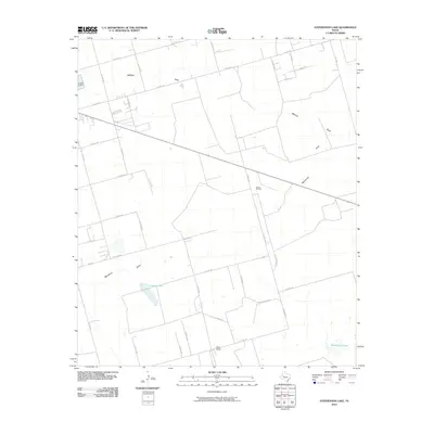
2010 Map of Stephenson Lake
USGS Topo · Published 2010About this map
The Azalea Oil Field and scattered ranching interests define this portion of the Permian Basin during the early twenty-first century. This landscape in eastern Midland County is characterized by a dense grid of county roads and private ranch routes, including PVT RCH RD and PVT Ranch RD, which provide access to the region's energy infrastructure and agricultural lands. The terrain is marked by ephemeral water features and depressions common to the Llano Estacado, most notably the seasonal catchments of Stephenson Lake and Consavvy Lake, along with several drainage paths simply labeled as Draw.
Find a feature on this map
33 named features on this map. Tap any name to fly to it.
Don’t see what you’re looking for? This feature index may not catch every label — zoom into the map to look around manually.
Map Details
Editions of this 2010 Stephenson Lake Map
This is the sole edition of this map. No revisions or reprints were ever made.
Other maps of this area

1954 · Hobbs
USGS Topo · 1:250,000

1954 · Pecos
USGS Topo · 1:250,000

1954 · Big Spring
USGS Topo · 1:250,000

1954 · San Angelo
USGS Topo · 1:250,000

1957 · Pecos
USGS Topo · 1:250,000

1958 · San Angelo
USGS Topo · 1:250,000

1958 · Big Spring
USGS Topo · 1:250,000

1958 · Hobbs
USGS Topo · 1:250,000

1964 · Bryant Ranch
USGS Topo · 1:24,000

1965 · San Angelo
USGS Topo · 1:250,000