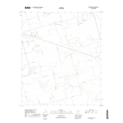
2019 Map of Stephenson Lake
USGS Topo · Published 2019About this map
Monahans Draw and Midland Draw define the drainage patterns across this section of Midland County, where the landscape is etched by ephemeral watercourses. This 2019 survey documents a rural Texas environment dominated by a grid-like network of county roads and ranch access points, such as Crespin Ranch Rd and various routes designated as Pvt Rch Rd. The transit network is anchored by E FM 158, which cuts diagonally across the northern half of the quadrangle. The map reveals the persistence of traditional ranching boundaries and the infrastructure of the Permian Basin, evidenced by the numerous unnamed depressions and the scattered development along routes like Ranch Rd 1213 and FM 1379. Researchers can trace the modern road evolution from established state roads to local gravel and private tracks.
Find a feature on this map
38 named features on this map. Tap any name to fly to it.
Don’t see what you’re looking for? This feature index may not catch every label — zoom into the map to look around manually.
Map Details
Editions of this 2019 Stephenson Lake Map
This is the sole edition of this map. No revisions or reprints were ever made.
Other maps of this area

1954 · Hobbs
USGS Topo · 1:250,000

1954 · Pecos
USGS Topo · 1:250,000

1954 · Big Spring
USGS Topo · 1:250,000

1954 · San Angelo
USGS Topo · 1:250,000

1957 · Pecos
USGS Topo · 1:250,000

1958 · San Angelo
USGS Topo · 1:250,000

1958 · Big Spring
USGS Topo · 1:250,000

1958 · Hobbs
USGS Topo · 1:250,000

1964 · Bryant Ranch
USGS Topo · 1:24,000

1965 · San Angelo
USGS Topo · 1:250,000