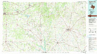
1985 Map of Stephenville
USGS Topo · Published 1992About this map
Stephenville and the surrounding Erath County countryside are defined by a high-relief landscape of mesas and ridges that separate the drainage basins of the Leon River and the Paluxy River. This 1985 compilation reflects a region shaped by early 20th-century oil booms and long-standing ranching traditions, evident in the network of small settlements like Desdemona and Olden. To the northwest, the city of Eastland sits near Lake Eastland, while the topography rises toward distinctive landmarks such as Yellow Face Mountain and McQuirt Mtn.
Find a feature on this map
127 named features on this map. Tap any name to fly to it.
Don’t see what you’re looking for? This feature index may not catch every label — zoom into the map to look around manually.
Map Details
Editions of this 1985 Stephenville Map
2 editions found
Other maps of this area

1887 · Coleman
USGS Topo · 1:125,000

1888 · Hamilton
USGS Topo · 1:125,000

1888 · Meridian
USGS Topo · 1:125,000

1889 · Granbury
USGS Topo · 1:125,000

1889 · Brownwood
USGS Topo · 1:125,000

1889 · Coleman
USGS Topo · 1:125,000

1890 · Stephenville
USGS Topo · 1:125,000

1890 · Breckenridge
USGS Topo · 1:125,000

1891 · Weatherford
USGS Topo · 1:125,000

1891 · Palo Pinto
USGS Topo · 1:125,000