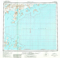
1963 Map of Stepovak Bay
USGS Topo · Published 1981About this map
Perryville and Ivanof anchor this 1963 survey of the southern edge of the Alaska Peninsula, where the Aleutian Range meets the volatile waters of the North Pacific. The landscape is defined by deep fjords and maritime industrial outposts, including a Cannery at the head of Ivanof Bay and scattered Cabins along the shoreline. The intricate coastal geography reveals traditional travel corridors like the Smoky Hollow Portage, which connects Stepovak Bay to the northern coastline across the narrow neck of the peninsula.
Find a feature on this map
96 named features on this map. Tap any name to fly to it.
Don’t see what you’re looking for? This feature index may not catch every label — zoom into the map to look around manually.
Map Details
Editions of this 1963 Stepovak Bay Map
3 editions found

Other maps of this area

1951 · Stepovak Bay
USGS Topo · 1:250,000

1951 · Sutwik Island
USGS Topo · 1:250,000

1953 · Port Moller
USGS Topo · 1:250,000

1963 · Port Moller A-1
USGS Topo · 1:63,360

1963 · Stepovak Bay D-2
USGS Topo · 1:63,360

1963 · Chignik A-4
USGS Topo · 1:63,360
1963 · Stepovak Bay C-5 and C-6
USGS Topo · 1:63,360

1963 · Stepovak Bay D-4
USGS Topo · 1:63,360

1963 · Chignik A-6
USGS Topo · 1:63,360
1963 · Simeonof Island D-2
USGS Topo · 1:63,360