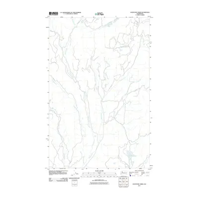
2011 Map of Stepstone Creek
USGS Topo · Published 2011About this map
Stepstone Creek and the Nespelem River carve through this Okanogan County landscape, forming a network of high-country drainage systems within the Colville Indian Reservation. The map reveals a remote geography defined by its water resources, with Gold Lake situated in the northern reaches and the twin basins of Owhi Lake and Little Owhi Lake appearing in the southeast. A system of Bureau of Indian Affairs (BIA) routes, such as Bia 116 RD and Gold Lake Rd, provide the primary access through the creek valleys and upland areas. Smaller tributaries including North Star Creek, Kinkaid Creek, and Parmenter Creek feed the larger river system, illustrating the intricate hydrology of this part of Washington during the early 21st century.
Find a feature on this map
19 named features on this map. Tap any name to fly to it.
Don’t see what you’re looking for? This feature index may not catch every label — zoom into the map to look around manually.
Map Details
Editions of this 2011 Stepstone Creek Map
This is the sole edition of this map. No revisions or reprints were ever made.
Other maps of this area

1950 · Nespelem
USGS Topo · 1:62,500

1950 · Alameda Flat
USGS Topo · 1:62,500

1952 · Alameda Flat
USGS Topo · 1:62,500

1952 · Disautel
USGS Topo · 1:62,500

1953 · Bald Knob
USGS Topo · 1:62,500

1954 · Okanogan
USGS Topo · 1:250,000

1958 · Okanogan
USGS Topo · 1:250,000
1983 · Omak
USGS Topo · 1:100,000

1984 · Nespelem
USGS Topo · 1:100,000

1986 · Central Peak
USGS Topo · 1:24,000