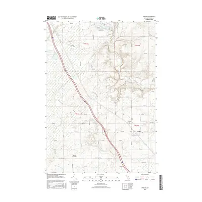
2017 Map of Sterling
USGS Topo · Published 2017About this map
Sterling serves as the primary hub in this portion of Arenac County, where the intersection of W State St and N Locust St anchors the local settlement. The landscape is defined by a dense network of watercourses, including the Rifle River and several branches of the Pine River, such as the N Br Pine River and Middle Br Pine River. These waterways, along with Richter Cr and Pumalee Cr, historically shaped the development of the region's agricultural and residential layout. Local heritage is preserved in several burial grounds like Saint George Cem and Sterling Cem, which sit near the village center, and the more distant Alger Cem to the northwest. The presence of Morres Junction and the small settlement of Melita reflect the historical rural transport and community nodes that established the area's footprint beyond the main village core.
Find a feature on this map
64 named features on this map. Tap any name to fly to it.
Don’t see what you’re looking for? This feature index may not catch every label — zoom into the map to look around manually.
Map Details
Editions of this 2017 Sterling Map
This is the sole edition of this map. No revisions or reprints were ever made.
Other maps of this area

1954 · Traverse City
USGS Topo · 1:250,000

1954 · Midland
USGS Topo · 1:250,000

1954 · Flint
USGS Topo · 1:250,000

1954 · Tawas City
USGS Topo · 1:250,000

1958 · Traverse City
USGS Topo · 1:250,000

1958 · Flint
USGS Topo · 1:250,000

1958 · Tawas City
USGS Topo · 1:250,000

1958 · Midland
USGS Topo · 1:250,000

1959 · Midland
USGS Topo · 1:250,000

1966 · Midland
USGS Topo · 1:250,000