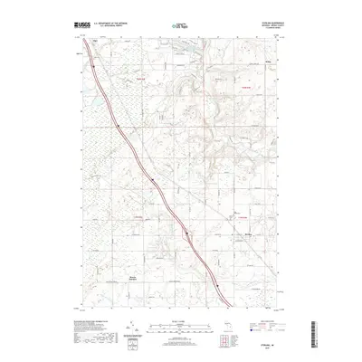
2019 Map of Sterling
USGS Topo · Published 2019About this map
Sterling and the rural townships of Arenac County are defined by a network of creeks and tributaries flowing toward the Great Lakes. This modern landscape reveals the persistent patterns of 19th-century settlement, from the small community of Alger in the northwest to the junction at Morres Junction further south. The Rifle River and its branches, including Richter Cr and Parmalee Cr, carve through the terrain, while newer developments are clustered around Forest Lake and Lake Charlyle. Local history is anchored by sites such as the Saint George Cem, Sterling Cem, and Alger Cem, which serve as genealogical touchstones for families of the Deep River area. The map illustrates how contemporary infrastructure follow the same lines as early township boundaries and watercourses like the Middle Br Pine River and Wells Cr.
Find a feature on this map
61 named features on this map. Tap any name to fly to it.
Don’t see what you’re looking for? This feature index may not catch every label — zoom into the map to look around manually.
Map Details
Editions of this 2019 Sterling Map
This is the sole edition of this map. No revisions or reprints were ever made.
Other maps of this area

1954 · Traverse City
USGS Topo · 1:250,000

1954 · Midland
USGS Topo · 1:250,000

1954 · Flint
USGS Topo · 1:250,000

1954 · Tawas City
USGS Topo · 1:250,000

1958 · Traverse City
USGS Topo · 1:250,000

1958 · Flint
USGS Topo · 1:250,000

1958 · Tawas City
USGS Topo · 1:250,000

1958 · Midland
USGS Topo · 1:250,000

1959 · Midland
USGS Topo · 1:250,000

1966 · Midland
USGS Topo · 1:250,000