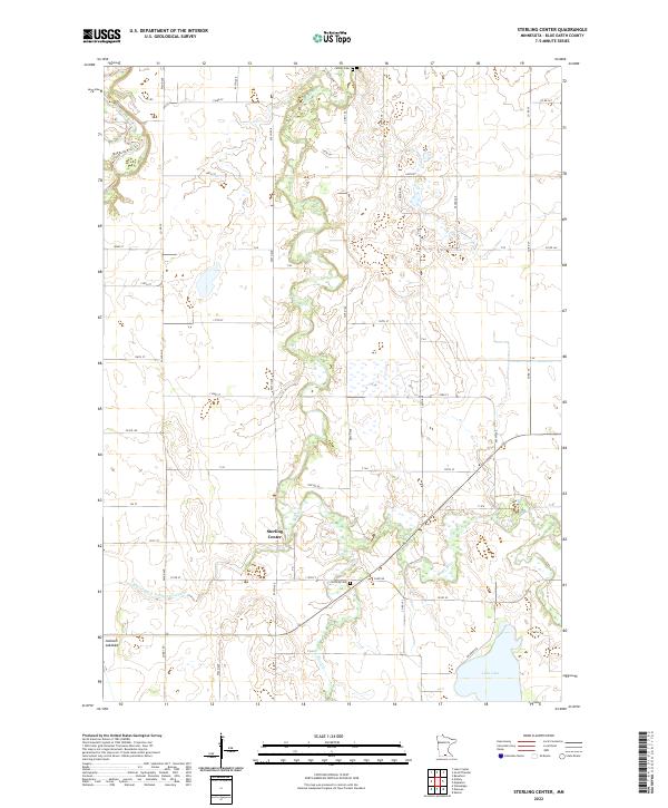
2022 Map of Sterling Center
USGS Topo · Published 2022About this map
Sterling Center occupies the heart of this rural landscape in Blue Earth County, where the meandering Maple River winds northward through a grid of agricultural section lines and county roads. The terrain is defined by its drainage patterns, from the northern reach of the Blue Earth River to the engineered precision of Judicial Ditch Number Fortynine. Genealogists and local historians can locate established burial grounds such as Sterling Cem and Calvary Cem, providing essential touchstones for family research in this township. The southern portion of the map is notable for its varied hydrology, featuring the open waters of Lura Lake and the distinct contours of the Jackson Lakebed. This survey captures a moment in the modern era where the ancestral settlement patterns of the 19th century still align with the intensive land use of today's Minnesota prairie.
Find a feature on this map
60 named features on this map. Tap any name to fly to it.
Don’t see what you’re looking for? This feature index may not catch every label — zoom into the map to look around manually.
Map Details
Editions of this 2022 Sterling Center Map
This is the sole edition of this map. No revisions or reprints were ever made.
Other maps of this area

1950 · Mankato East
USGS Topo · 1:62,500

1951 · Mankato East
USGS Topo · 1:62,500

1951 · Mankato West
USGS Topo · 1:62,500

1953 · Saint Paul
USGS Topo · 1:250,000

1953 · New Ulm
USGS Topo · 1:250,000

1954 · Fairmont
USGS Topo · 1:250,000

1954 · Mason City
USGS Topo · 1:250,000

1957 · New Ulm
USGS Topo · 1:250,000

1957 · Mason City
USGS Topo · 1:250,000

1958 · New Ulm
USGS Topo · 1:250,000