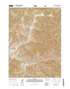
2014 Map of Sterling Creek
USGS Topo · Published 2014About this map
Buncom sits at the southwestern edge of this landscape, a point where the terrain rises from the Little Applegate River valley into the high ridges of the Rogue River National Forest. The map is defined by a dense network of gulches and ridges, carved by waterways like Sterling Creek and Griffin Cr. One of the most significant historical markers here is the China Ditch, which follows the contours of the hills south of Cantrall Gulch, a reminder of the hydraulic mining infrastructure that once transformed this region. The northern heights are dominated by Nelson Mtn and Anderson Butte, while local history is preserved at the Sterling Cem near Hopkins Gulch. Water management is evident through features like Schlesinger Reservoir and Brown Reservoir, supporting the land between the steep descents of Eagle Canyon and Frazier Gulch.
Find a feature on this map
101 named features on this map. Tap any name to fly to it.
Don’t see what you’re looking for? This feature index may not catch every label — zoom into the map to look around manually.
Map Details
Editions of this 2014 Sterling Creek Map
This is the sole edition of this map. No revisions or reprints were ever made.
Other maps of this area

1891 · Ashland
USGS Topo · 1:250,000

1893 · Ashland
USGS Topo · 1:250,000

1897 · Ashland
USGS Topo · 1:250,000

1908 · Grants Pass
USGS Topo · 1:125,000

1938 · Medford
USGS Topo · 1:125,000

1954 · Medford
USGS Topo · 1:62,500

1954 · Gold Hill
USGS Topo · 1:62,500

1954 · Talent
USGS Topo · 1:62,500

1954 · Ruch
USGS Topo · 1:62,500

1955 · Medford
USGS Topo · 1:250,000