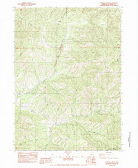
1983 Map of Sterling Creek
USGS Topo · Published 1983About this map
The Sterling Creek drainage and the steep canyons of the Rogue River National Forest dominate this landscape in southern Jackson County. The settlement of Buncom serves as a historic focal point where several gulches and ridges converge, reflecting the region's long-standing connection to the wood and water of the Siskiyou Mountains. To the east, the topography rises toward Anderson Butte and Nelson Mountain, punctuated by a dense network of watercourses including Little Luck Creek and Griffin Creek.
Find a feature on this map
50 named features on this map. Tap any name to fly to it.
Don’t see what you’re looking for? This feature index may not catch every label — zoom into the map to look around manually.
Map Details
Editions of this 1983 Sterling Creek Map
This is the sole edition of this map. No revisions or reprints were ever made.
Other maps of this area

1891 · Ashland
USGS Topo · 1:250,000

1893 · Ashland
USGS Topo · 1:250,000

1897 · Ashland
USGS Topo · 1:250,000

1908 · Grants Pass
USGS Topo · 1:125,000

1938 · Medford
USGS Topo · 1:125,000

1954 · Medford
USGS Topo · 1:62,500

1954 · Gold Hill
USGS Topo · 1:62,500

1954 · Talent
USGS Topo · 1:62,500

1954 · Ruch
USGS Topo · 1:62,500

1955 · Medford
USGS Topo · 1:250,000