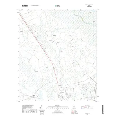
2020 Map of Sterling
USGS Topo · Published 2020About this map
The Altamaha River system dominates the northern boundary of this coastal Georgia landscape, where the main channel splits into the South Branch Altamaha River and the South Branch South Altamaha River. These waterways frame a dense network of wetlands and islands including Lewis Island, Cambers Island, and Wrights Island. The interior terrain is characterized by a series of "galls" and "swamps" such as Boggy Gall, Clayhole Swamp, and Honeygall Swamp, which dictate the placement of local infrastructure.
Find a feature on this map
120 named features on this map. Tap any name to fly to it.
Don’t see what you’re looking for? This feature index may not catch every label — zoom into the map to look around manually.
Map Details
Editions of this 2020 Sterling Map
This is the sole edition of this map. No revisions or reprints were ever made.
Other maps of this area

1918 · Everett City
USGS Topo · 1:62,500

1918 · Bladen
USGS Topo · 1:62,500

1920 · Everett City
USGS Topo · 1:62,500

1921 · Darien
USGS Topo · 1:62,500

1939 · Bladen
USGS Topo · 1:62,500

1944 · Everett City
USGS Topo · 1:62,500

1945 · Brunswick
USGS Topo · 1:62,500

1946 · Brunswick
USGS Topo · 1:250,000

1948 · Brunswick
USGS Topo · 1:250,000
1954 · Ridgeville
USGS Topo · 1:24,000