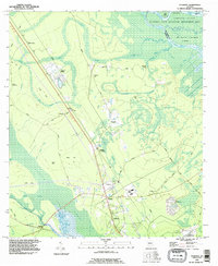
1993 Map of Sterling
USGS Topo · Published 1995About this map
The Altamaha River and its intricate network of island and swamp ecosystems dominate this late-twentieth-century study of the Georgia coast. The river's influence is clear through the naming of Lewis Island, Cambers Island, and the protected wetlands of the Altamaha State Waterfowl Management Area. This landscape is characterized by a mix of low-lying wetlands like Little Buffalo Swamp and slightly elevated hammocks such as Smith Hammock and Pennant Hill.
Find a feature on this map
52 named features on this map. Tap any name to fly to it.
Don’t see what you’re looking for? This feature index may not catch every label — zoom into the map to look around manually.
Map Details
Editions of this 1993 Sterling Map
This is the sole edition of this map. No revisions or reprints were ever made.
Other maps of this area

1918 · Everett City
USGS Topo · 1:62,500

1918 · Bladen
USGS Topo · 1:62,500

1920 · Everett City
USGS Topo · 1:62,500

1921 · Darien
USGS Topo · 1:62,500

1939 · Bladen
USGS Topo · 1:62,500

1944 · Everett City
USGS Topo · 1:62,500

1945 · Brunswick
USGS Topo · 1:62,500

1946 · Brunswick
USGS Topo · 1:250,000

1948 · Brunswick
USGS Topo · 1:250,000
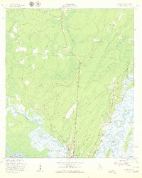
1954 · Ridgeville
USGS Topo · 1:24,000