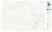
1983 Map of Sterling
USGS Topo · Published 1983About this map
Sterling serves as the regional anchor for this 1983 topographic survey, situated where the South Platte River and major rail lines like the Union Pacific converge. The landscape is defined by the transition from the high, flat surface of Peetz Table in the north to the fertile river valley near Atwood and Iliff. A complex network of irrigation and water management is visible through features like the North Sterling Reservoir and numerous draws including Sidney Draw and Spring Draw.
Find a feature on this map
54 named features on this map. Tap any name to fly to it.
Don’t see what you’re looking for? This feature index may not catch every label — zoom into the map to look around manually.
Map Details
Editions of this 1983 Sterling Map
This is the sole edition of this map. No revisions or reprints were ever made.
Other maps of this area

1899 · Sidney
USGS Topo · 1:125,000

1951 · Dead Horse Springs
USGS Topo · 1:24,000

1951 · Reiradon Hill
USGS Topo · 1:24,000

1951 · Willard
USGS Topo · 1:24,000

1951 · Messex
USGS Topo · 1:24,000

1951 · Sterling South
USGS Topo · 1:24,000

1951 · Sunken Lake
USGS Topo · 1:24,000

1951 · Sterling North
USGS Topo · 1:24,000

1951 · Galien
USGS Topo · 1:24,000

1951 · Antelope Springs
USGS Topo · 1:24,000