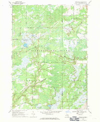
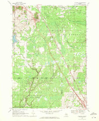
1968 Map of Sterling SW
USGS Topo · Published 1971About this map
Tittabawassee River State Forest dominates this landscape in central Michigan, where complex water management systems define the terrain. The presence of multiple flooding projects, including Molasses River Flooding No 1, Molasses River Flooding No 2, and Molasses River Flooding No 5, indicates a mid-century focus on habitat engineering and wetland control along the Molasses River.
Find a feature on this map
28 named features on this map. Tap any name to fly to it.
Don’t see what you’re looking for? This feature index may not catch every label — zoom into the map to look around manually.
Map Details
Editions of this 1968 Sterling SW Map
This is the sole edition of this map. No revisions or reprints were ever made.
Other maps of this area

1954 · Traverse City
USGS Topo · 1:250,000

1954 · Midland
USGS Topo · 1:250,000

1958 · Traverse City
USGS Topo · 1:250,000

1958 · Midland
USGS Topo · 1:250,000

1959 · Midland
USGS Topo · 1:250,000

1966 · Midland
USGS Topo · 1:250,000
1967 · Mount Forest
USGS Topo · 1:24,000
1968 · Sterling
USGS Topo · 1:24,000
1968 · Skidway Lake
USGS Topo · 1:24,000
1968 · Sterling NW
USGS Topo · 1:24,000