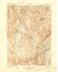
1940 Map of Sterling
USGS Topo · Published 1940About this map
Oakdale and Sterling Junction serve as key hubs in this Worcester County landscape, where the Boston and Maine Railroad weaves through a network of waterways feeding the Wachusett Reservoir. The map documents critical infrastructure of the era, including the Quabbin Aqueduct with visible markers for Shaft 1, Shaft 2, and Shaft 3. This subterranean engineering feat mirrors the complex surface water system defined by the Stillwater River and Stillwater Basin.
Find a feature on this map
91 named features on this map. Tap any name to fly to it.
Don’t see what you’re looking for? This feature index may not catch every label — zoom into the map to look around manually.
Map Details
Editions of this 1940 Sterling Map
2 editions found
Other maps of this area

1885 · Worcester
USGS Topo · 1:62,500

1886 · Worcester
USGS Topo · 1:62,500

1887 · Marlboro
USGS Topo · 1:62,500

1887 · Fitchburg
USGS Topo · 1:62,500

1889 · Marlboro
USGS Topo · 1:62,500

1889 · Fitchburg
USGS Topo · 1:62,500

1892 · Worcester
USGS Topo · 1:62,500

1893 · Fitchburg
USGS Topo · 1:62,500

1893 · Groton
USGS Topo · 1:62,500

1896 · Marlboro
USGS Topo · 1:62,500