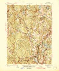
1946 Map of Sterling
USGS Topo · Published 1946About this map
Lake Waushacum and its neighboring ponds anchor the central landscape of this 1946 study, which documents the rural character and expanding infrastructure of central Massachusetts just after the war. The map highlights the complex water systems of the region, including the Quabbin Aqueduct with several shafts such as Shaft 1 and Shaft 2, indicating the importance of regional water management for the growing population. Settlement patterns are concentrated around hubs like Sterling Junction and Oakdale, while the Boston and Maine RR provides the primary industrial artery through the valleys.
Find a feature on this map
64 named features on this map. Tap any name to fly to it.
Don’t see what you’re looking for? This feature index may not catch every label — zoom into the map to look around manually.
Map Details
Editions of this 1946 Sterling Map
2 editions found
Other maps of this area

1885 · Worcester
USGS Topo · 1:62,500

1886 · Worcester
USGS Topo · 1:62,500

1887 · Marlboro
USGS Topo · 1:62,500

1887 · Fitchburg
USGS Topo · 1:62,500

1889 · Marlboro
USGS Topo · 1:62,500

1889 · Fitchburg
USGS Topo · 1:62,500

1892 · Worcester
USGS Topo · 1:62,500

1893 · Fitchburg
USGS Topo · 1:62,500

1893 · Groton
USGS Topo · 1:62,500

1896 · Marlboro
USGS Topo · 1:62,500