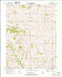
1957 Map of Stet
USGS Topo · Published 1979About this map
Wakenda Creek and its many tributaries, including Crabapple Creek and Cottonwood Creek, define the agricultural landscape of this region during the mid-twentieth century. Small communities and rural gathering places like Regal, Log Cabin Station, and Russellville are scattered across the drainage basins, illustrating a settlement pattern of independent farmsteads and local commerce. The southeastern corner is anchored by the town of Stet, where the Stet Sch and Bethany Ch served as central community landmarks for residents near the Ray Co Carroll Co line.
Find a feature on this map
21 named features on this map. Tap any name to fly to it.
Don’t see what you’re looking for? This feature index may not catch every label — zoom into the map to look around manually.
Map Details
Editions of this 1957 Stet Map
2 editions found
Other maps of this area

1889 · Lexington
USGS Topo · 1:125,000

1924 · Dawn
USGS Topo · 1:62,500

1924 · Braymer
USGS Topo · 1:62,500

1950 · Plymouth
USGS Topo · 1:24,000

1951 · Utica
USGS Topo · 1:62,500

1953 · Moberly
USGS Topo · 1:250,000

1954 · Moberly
USGS Topo · 1:250,000

1957 · Moberly
USGS Topo · 1:250,000
1957 · Roads
USGS Topo · 1:24,000
1957 · Stet
USGS Topo · 1:24,000