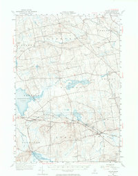
1955 Map of Stetson
USGS Topo · Published 1974About this map
Sebasticook Lake and the wetlands of Plymouth Bog and Etna Bog dominate this central Penobscot County landscape during the mid-1950s. The settlement pattern is defined by a dense network of small villages and crossings, including Exeter Center, Stetson, and Etna, many linked by the southern transit corridor of the Maine Central Railroad. Industrial remnants like McGregor Mill and French Mill Stream point to a local economy historically tied to water power, while the numerous family-named burial grounds such as Crowell Cem, Boutell Cem, and Page Cem provide a rich resource for genealogists. The map also captures infrastructure of the era, from the Durham Bridge at the northern tip of the lake to the Longfellow Sch in the south, reflecting a quiet period of rural Maine life before modern highway expansion shifted the region's focus.
Find a feature on this map
80 named features on this map. Tap any name to fly to it.
Don’t see what you’re looking for? This feature index may not catch every label — zoom into the map to look around manually.
Map Details
Editions of this 1955 Stetson Map
3 editions found
Other maps of this area

1900 · Bucksport
USGS Topo · 1:62,500

1902 · Bucksport
USGS Topo · 1:62,500

1902 · Bangor
USGS Topo · 1:62,500

1926 · Burnham
USGS Topo · 1:62,500

1930 · Pittsfield
USGS Topo · 1:48,000

1931 · Stetson
USGS Topo · 1:48,000

1932 · Brooks
USGS Topo · 1:62,500

1932 · Dover-Foxcroft
USGS Topo · 1:48,000

1932 · Pittsfield
USGS Topo · 1:62,500

1933 · Boyd Lake
USGS Topo · 1:62,500