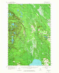
1958 Map of Steuben
USGS Topo · Published 1967About this map
Hiawatha National Forest dominates this section of the Upper Peninsula, where the landscape is defined by a dense network of glacial lakes and wetlands. During the late 1950s, small settlements like Steuben and Hiawatha served as focal points for local life, supported by infrastructure such as the Town Hall and the Steuben Lookout Tower. The presence of Hiawatha (Station) indicates the area's historical reliance on rail for transport through the timberlands, while several scattered Gravel Pits and a Quarry suggest ongoing local industry.
Find a feature on this map
77 named features on this map. Tap any name to fly to it.
Don’t see what you’re looking for? This feature index may not catch every label — zoom into the map to look around manually.
Map Details
Editions of this 1958 Steuben Map
2 editions found
Other maps of this area

1931 · Cooks NE
USGS Topo · 1:31,680

1931 · Steuben SE
USGS Topo · 1:31,680

1931 · Steuben SW
USGS Topo · 1:31,680

1931 · Steuben NE
USGS Topo · 1:31,680

1931 · Cooks NW
USGS Topo · 1:31,680

1931 · Shingleton SW
USGS Topo · 1:31,680

1931 · Steuben NW
USGS Topo · 1:31,680

1931 · Manistique River NW
USGS Topo · 1:31,680

1931 · Skeels Lake NE
USGS Topo · 1:31,680

1931 · Shingleton SE
USGS Topo · 1:31,680