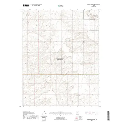
2020 Map of Stevens Canyon North
USGS Topo · Published 2020About this map
Water Pocket Fold dominates this high-desert landscape, where the sharp geologic uplift creates a complex system of drainage and erosion. The northern portion of the map is defined by the boundary of Capitol Reef National Park, which contains the dramatic Grand Gulch and the winding course of Halls Cr. The southern half transitions into the Glen Canyon National Recreation Area, centered on the namesake Stevens Canyon. This 2020 survey records the topographic intersection of these two major federal preserves across the line between Garfield and Kane counties. The terrain is notably rugged, with drainage features like Millers Cr and the tight constrictions of the Halls Creek and Narrows providing the primary landmarks in an area otherwise devoid of human settlement or established roadways.
Find a feature on this map
9 named features on this map. Tap any name to fly to it.
Don’t see what you’re looking for? This feature index may not catch every label — zoom into the map to look around manually.
Map Details
Editions of this 2020 Stevens Canyon North Map
This is the sole edition of this map. No revisions or reprints were ever made.
Other maps of this area

1886 · Escalante
USGS Topo · 1:250,000

1886 · Henry Mountains
USGS Topo · 1:250,000

1892 · Henry Mountains
USGS Topo · 1:250,000

1953 · Mt Pennell 3 NW
USGS Topo · 1:24,000

1953 · Mt Pennell 3 SW
USGS Topo · 1:24,000

1953 · Circle Cliffs 4 NE
USGS Topo · 1:24,000

1953 · The Rincon
USGS Topo · 1:62,500

1953 · Hall Mesa
USGS Topo · 1:62,500

1953 · Moody Creek
USGS Topo · 1:62,500

1956 · Escalante
USGS Topo · 1:250,000