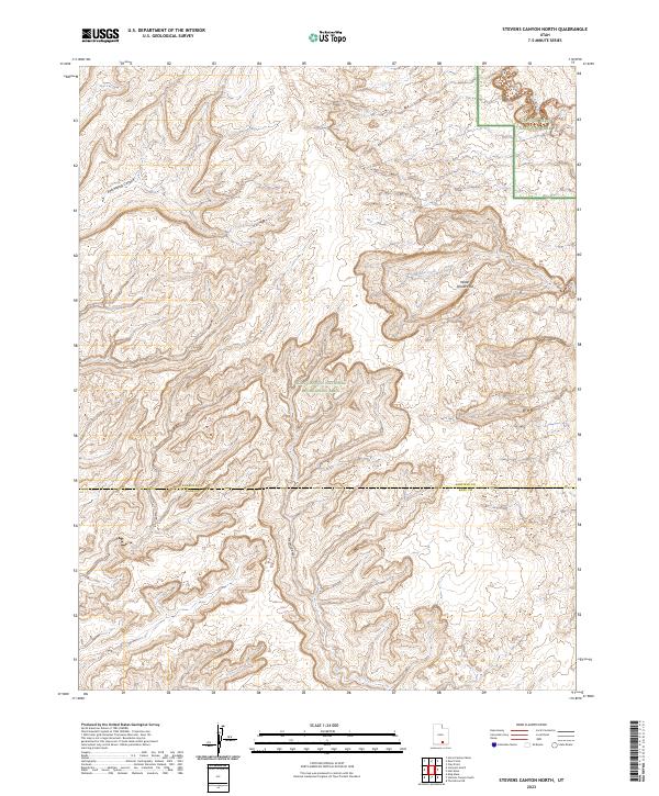
2023 Map of Stevens Canyon North
USGS Topo · Published 2023About this map
Water Pocket Fold dominates the eastern reaches of this landscape, marking a significant geologic uplift within the southern portion of Capitol Reef National Park. The survey captures the complex drainage systems of the high desert, where Millers Creek and Halls Creek carve deep through the sandstone strata. Much of the southern and central terrain is preserved within the Glen Canyon National Recreation Area, showing an intricate network of drainages including East Moody Canyon and its namesake Stevens Canyon. Spanning the administrative boundary between Garfield and Kane Counties, this map illustrates a wilderness shaped by erosion and elevation, largely untouched by modern infrastructure or permanent settlements. The topographical data provides a precise record of the winding canyon floors and mesa rims that define this section of the Colorado Plateau.
Find a feature on this map
8 named features on this map. Tap any name to fly to it.
Don’t see what you’re looking for? This feature index may not catch every label — zoom into the map to look around manually.
Map Details
Editions of this 2023 Stevens Canyon North Map
This is the sole edition of this map. No revisions or reprints were ever made.
Other maps of this area

1886 · Escalante
USGS Topo · 1:250,000

1886 · Henry Mountains
USGS Topo · 1:250,000

1892 · Henry Mountains
USGS Topo · 1:250,000

1953 · Mt Pennell 3 NW
USGS Topo · 1:24,000

1953 · Mt Pennell 3 SW
USGS Topo · 1:24,000

1953 · Circle Cliffs 4 NE
USGS Topo · 1:24,000

1953 · The Rincon
USGS Topo · 1:62,500

1953 · Hall Mesa
USGS Topo · 1:62,500

1953 · Moody Creek
USGS Topo · 1:62,500

1956 · Escalante
USGS Topo · 1:250,000