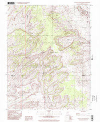
1997 Map of Stevens Canyon North
USGS Topo · Published 2002About this map
The Waterpocket Fold dominates the eastern section of this landscape, marking a massive monocline that defines the geology of southern Utah. As seen in this survey based on late 20th-century imagery, the terrain transitions through the Glen Canyon National Recreation Area and into the southernmost reaches of Capitol Reef National Park. The intricate drainage patterns of Stevens Canyon and Moody Canyon illustrate the erosional forces that have carved this portion of the Colorado Plateau.
Find a feature on this map
9 named features on this map. Tap any name to fly to it.
Don’t see what you’re looking for? This feature index may not catch every label — zoom into the map to look around manually.
Map Details
Editions of this 1997 Stevens Canyon North Map
This is the sole edition of this map. No revisions or reprints were ever made.
Other maps of this area

1886 · Escalante
USGS Topo · 1:250,000

1886 · Henry Mountains
USGS Topo · 1:250,000

1892 · Henry Mountains
USGS Topo · 1:250,000

1953 · Mt Pennell 3 NW
USGS Topo · 1:24,000

1953 · Mt Pennell 3 SW
USGS Topo · 1:24,000

1953 · Circle Cliffs 4 NE
USGS Topo · 1:24,000

1953 · The Rincon
USGS Topo · 1:62,500

1953 · Hall Mesa
USGS Topo · 1:62,500

1953 · Moody Creek
USGS Topo · 1:62,500

1956 · Escalante
USGS Topo · 1:250,000