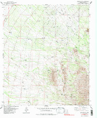
1979 Map of Stevens Mtn.
USGS Topo · Published 1985About this map
Stevens Mtn and the southern Sierra Mountains anchor this arid landscape of the late 1970s, defined by its intensive mining history and sprawling ranch lands. The terrain is marked by numerous mineral claims, including the Philomena Mine, Aguinaldo Mine, and the Montezuma Mine, interspersed with several prospect sites. This concentration of small-scale mining operations suggests a period of active exploration and extraction in the rocky outcrops surrounding Providencia Hill. Down from the peaks, the drainage patterns of Fresnal Wash, Banner Wash, and Ash Wash dictate the layout of the land, leading to localized cattle infrastructure like the Stevens Ranch and the Bristo Ranch. The northern portion of the map shows a shift toward rural residential development, where a grid of named roads like Diamond Bell Ranch Road and Stagecoach Road begins to penetrate the desert scrub.
Find a feature on this map
61 named features on this map. Tap any name to fly to it.
Don’t see what you’re looking for? This feature index may not catch every label — zoom into the map to look around manually.
Map Details
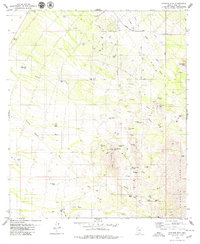
Editions of this 1979 Stevens Mtn. Map
2 editions found
Other maps of this area

1920 · Arivaca
USGS Topo · 1:125,000

1925 · Samaniego Peak
USGS Topo · 1:62,500

1925 · San Xavier
USGS Topo · 1:62,500

1934 · Tucson Mountains
USGS Topo · 1:125,000

1939 · Twin Buttes
USGS Topo · 1:62,500

1940 · Palo Alto Ranch
USGS Topo · 1:62,500

1941 · Twin Buttes
USGS Topo · 1:62,500

1941 · Cocoraque Butte
USGS Topo · 1:62,500

1943 · Cocoraque Butte
USGS Topo · 1:62,500

1943 · Palo Alto Ranch
USGS Topo · 1:62,500