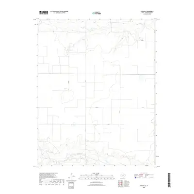
2019 Map of Stevens SE
USGS Topo · Published 2019About this map
Coldwater Cr meanders across the southern portion of this Sherman County landscape, providing a rare riparian break in the high plains terrain. This 2019 survey captures the vast agricultural layout of the Texas Panhandle, defined by a rigid grid of rural roads and center-pivot irrigation infrastructure. To the north, the drainage of Frisco Cr cuts into the plateau, creating more varied relief compared to the level fields that dominate the central region. The map documents the critical transportation network supporting the area's farming economy, from the paved corridor of Fm 119 to local connectors like Judges Rd and Co Rd K. These roads provide access to the large-scale ranching and farming operations that have defined this portion of the Texas plains for generations.
Find a feature on this map
10 named features on this map. Tap any name to fly to it.
Don’t see what you’re looking for? This feature index may not catch every label — zoom into the map to look around manually.
Map Details
Editions of this 2019 Stevens SE Map
This is the sole edition of this map. No revisions or reprints were ever made.
Other maps of this area

1954 · Perryton
USGS Topo · 1:250,000

1958 · Perryton
USGS Topo · 1:250,000

1964 · Stevens SW
USGS Topo · 1:24,000

1965 · Spurlock Chapel
USGS Topo · 1:24,000

1965 · Stevens
USGS Topo · 1:24,000

1974 · Sunray 1 NW
USGS Topo · 1:24,000

1974 · Texhoma South
USGS Topo · 1:24,000

1974 · Stevens SE
USGS Topo · 1:24,000

1974 · Sunray 1 SW
USGS Topo · 1:24,000

1974 · Capps Switch NW
USGS Topo · 1:24,000