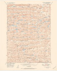
1951 Map of Steverson Lake
USGS Topo · Published 1951About this map
Arkansas Valley and the vast ranchlands of Cherry County define this mid-century portrait of the Nebraska Sandhills. The landscape is a complex network of shallow basins and internal drainage systems, where isolated water bodies like Steverson Lake and Pelican Lake punctuate the arid terrain. Settlement patterns are sparse, dictated by the availability of water and the needs of cattle ranching, with long-established family operations such as the Knudsen Ranch, Metzger Ranch, and Henderson Ranch serving as the primary landmarks across the Enlow Valley and Survey Valley.
Find a feature on this map
55 named features on this map. Tap any name to fly to it.
Don’t see what you’re looking for? This feature index may not catch every label — zoom into the map to look around manually.
Map Details
Editions of this 1951 Steverson Lake Map
2 editions found
Other maps of this area

1948 · Ashby
USGS Topo · 1:62,500

1948 · Whitman
USGS Topo · 1:62,500

1949 · Ashby
USGS Topo · 1:62,500

1949 · Steverson Lake
USGS Topo · 1:62,500

1949 · Turpin Lake
USGS Topo · 1:62,500

1950 · Whitman
USGS Topo · 1:62,500

1950 · Hire
USGS Topo · 1:62,500

1950 · Doughboy
USGS Topo · 1:62,500

1950 · Wolf Lake
USGS Topo · 1:62,500

1951 · Steverson Lake
USGS Topo · 1:62,500