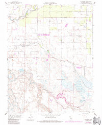
1961 Map of Stevinson
USGS Topo · Published 1987About this map
Stevinson and the surrounding Central Valley ranch lands are defined by an intricate network of water management features, where the Merced River and San Joaquin River converge. This 1961 survey, updated in the 1980s, captures the highly organized landscape of irrigation and drainage essential to local agriculture. The East Side Irrigation Canal cuts diagonally across the terrain, supplemented by numerous laterals like Lateral 8 and Lateral 4.
Find a feature on this map
49 named features on this map. Tap any name to fly to it.
Don’t see what you’re looking for? This feature index may not catch every label — zoom into the map to look around manually.
Map Details
Editions of this 1961 Stevinson Map
3 editions found
Other maps of this area

1916 · Mitchell School
USGS Topo · 1:31,680

1916 · Cressey
USGS Topo · 1:31,680

1917 · Turlock
USGS Topo · 1:31,680

1918 · Arena
USGS Topo · 1:31,680

1918 · Stevinson
USGS Topo · 1:31,680

1918 · Gustine
USGS Topo · 1:31,680

1918 · Turner Ranch
USGS Topo · 1:31,680

1919 · San Luis Ranch
USGS Topo · 1:31,680

1919 · Ingomar
USGS Topo · 1:31,680
1942 · Irwin
USGS Topo · 1:62,500