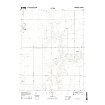
2015 Map of Stewardson East
USGS Topo · Published 2015About this map
The W Br Little Wabash River and its numerous tributaries, including Sexson Br and Brush Cr, define the drainage patterns of this eastern Shelby County landscape. Small rural communities like Strasburg, South Strasburg, and Stewardson anchor the western edge of the quadrangle, while Trowbridge and Kingman are situated further east among the winding creeks. The distribution of family and community burial grounds is particularly dense here, suggesting a long-established agricultural settlement pattern. Genealogists may find value in the specific locations of the Saint Patick's Cem, Rincker Cem, and the Lower Ash Grove Cem, along with others like the Swedish Cem and Spain Cem. These landmarks, along with named roads such as E Main St and N Elizabeth St, provide a precise spatial framework for tracing 21st-century local history.
Find a feature on this map
33 named features on this map. Tap any name to fly to it.
Don’t see what you’re looking for? This feature index may not catch every label — zoom into the map to look around manually.
Map Details
Editions of this 2015 Stewardson East Map
This is the sole edition of this map. No revisions or reprints were ever made.
Other maps of this area

1934 · Mattoon
USGS Topo · 1:62,500

1937 · Mattoon
USGS Topo · 1:62,500

1947 · Stewardson
USGS Topo · 1:62,500

1949 · Stewardson
USGS Topo · 1:62,500

1950 · Effingham
USGS Topo · 1:62,500

1951 · Effingham
USGS Topo · 1:62,500

1953 · Teutopolis
USGS Topo · 1:62,500

1958 · Decatur
USGS Topo · 1:250,000

1961 · Decatur
USGS Topo · 1:250,000

1980 · Middlesworth
USGS Topo · 1:24,000