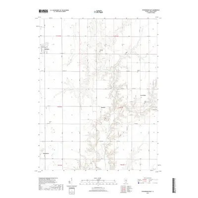
2018 Map of Stewardson East
USGS Topo · Published 2018About this map
Strasburg and the surrounding Shelby County countryside are defined by a network of family-named cemeteries and rural settlements near the upper reaches of the Little Wabash River. This 2018 survey shows a landscape dominated by agriculture and drainage systems, where small communities like Trowbridge and Kingman serve as local anchors. The map is particularly useful for genealogists, as it documents numerous burial sites including the Saint Patick's Cem, Swedish Cem, and Rincker Cem. The drainage patterns of Wolf Cr, Brush Cr, and the West Branch Little Wabash River illustrate the hydrology that dictated the placement of early farms and roads such as Clarksburg Rd and Centerline Rd. These natural features, combined with the detailed section lines of t10n r6e and adjacent townships, provide a clear view of land organization in this part of Illinois.
Find a feature on this map
46 named features on this map. Tap any name to fly to it.
Don’t see what you’re looking for? This feature index may not catch every label — zoom into the map to look around manually.
Map Details
Editions of this 2018 Stewardson East Map
This is the sole edition of this map. No revisions or reprints were ever made.
Other maps of this area

1934 · Mattoon
USGS Topo · 1:62,500

1937 · Mattoon
USGS Topo · 1:62,500

1947 · Stewardson
USGS Topo · 1:62,500

1949 · Stewardson
USGS Topo · 1:62,500

1950 · Effingham
USGS Topo · 1:62,500

1951 · Effingham
USGS Topo · 1:62,500

1953 · Teutopolis
USGS Topo · 1:62,500

1958 · Decatur
USGS Topo · 1:250,000

1961 · Decatur
USGS Topo · 1:250,000

1980 · Middlesworth
USGS Topo · 1:24,000