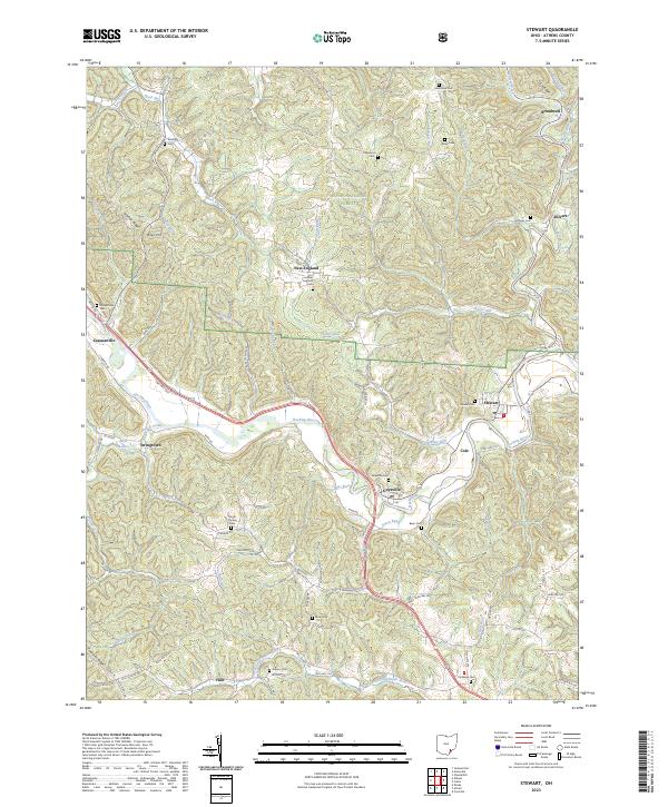
2023 Map of Stewart
USGS Topo · Published 2023About this map
The Hocking River carves a winding path through the heart of this Athens County landscape, linking the historic riverbank settlements of Canaanville, Guysville, and Stewart. This 2023 edition highlights a region defined by its narrow valleys and ridges, such as Scatter Ridge and Riley Hill, much of which is preserved within the Wayne National Forest. For those researching local history or genealogy, the map provides a precise census of rural burial grounds including Guysville Cem, Canaanville Cem, and Sterling Cem near Riley Hill. The southern reaches are shaped by the East Branch Shade River, while the northern hills around Broadwell and Kilvert are drained by Federal Creek. The intricate road network, featuring routes like S Canaan Rd and Coolville Ridge, reveals how modern transit continues to follow the historic contours of the river valley and its tributary runs like Mush Run and Sharps Run.
Find a feature on this map
88 named features on this map. Tap any name to fly to it.
Don’t see what you’re looking for? This feature index may not catch every label — zoom into the map to look around manually.
Map Details
Editions of this 2023 Stewart Map
This is the sole edition of this map. No revisions or reprints were ever made.
Other maps of this area

1903 · Athens
USGS Topo · 1:62,500

1904 · Chesterhill
USGS Topo · 1:62,500

1905 · Athens
USGS Topo · 1:62,500

1906 · Chesterhill
USGS Topo · 1:62,500

1907 · Pomeroy
USGS Topo · 1:62,500

1907 · Keno
USGS Topo · 1:62,500

1947 · Columbus
USGS Topo · 1:250,000

1949 · Clarksburg
USGS Topo · 1:250,000

1956 · Clarksburg
USGS Topo · 1:250,000
1960 · Alfred
USGS Topo · 1:24,000