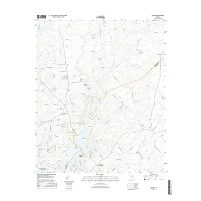
2017 Map of Stewart
USGS Topo · Published 2017About this map
Alcovy River frontage and the northern reaches of Jackson Lake define this portion of the Georgia Piedmont, where the borders of Newton, Jasper, and Butts counties meet. The landscape is characterized by its numerous shoals and necks along the water, including Factory Shoals and White Shoals, pointing to the historical importance of the river for both industry and early navigation. Small communities like Stewart and Hardys Crossroads serve as focal points for a landscape dotted with family and church burial grounds.
Find a feature on this map
169 named features on this map. Tap any name to fly to it.
Don’t see what you’re looking for? This feature index may not catch every label — zoom into the map to look around manually.
Map Details
Editions of this 2017 Stewart Map
This is the sole edition of this map. No revisions or reprints were ever made.
Other maps of this area

1896 · Monroe
USGS Topo · 1:125,000

1953 · Athens
USGS Topo · 1:250,000

1958 · Athens
USGS Topo · 1:250,000

1959 · Athens
USGS Topo · 1:250,000

1963 · Athens
USGS Topo · 1:250,000

1964 · Lloyd Shoals Dam
USGS Topo · 1:24,000
1964 · Jackson
USGS Topo · 1:24,000

1964 · Stewart
USGS Topo · 1:24,000

1964 · Worthville
USGS Topo · 1:24,000

1964 · Porterdale
USGS Topo · 1:24,000