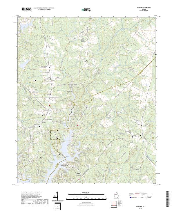
2024 Map of Stewart
USGS Topo · Published 2024About this map
Jackson Lake and its intricate series of peninsulas dominate this landscape where the boundaries of Newton, Jasper, and Butts Counties meet. Named points such as Parker Neck, Price Neck, and Hardy Neck extend into the reservoir, revealing a topography shaped by the impoundment of the Alcovy River. The map is particularly notable for its density of small family and community burial grounds, including the Macedonia Missionary Baptist Cem, Heard Cem, and Pickett Cem, which serve as vital markers for local genealogical research in this part of rural Georgia.
Find a feature on this map
179 named features on this map. Tap any name to fly to it.
Don’t see what you’re looking for? This feature index may not catch every label — zoom into the map to look around manually.
Map Details
Editions of this 2024 Stewart Map
This is the sole edition of this map. No revisions or reprints were ever made.
Historical Maps of Idlewood Through Time
4 maps found