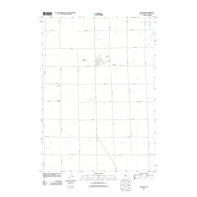
2012 Map of Stickney
USGS Topo · Published 2012About this map
The town of Stickney anchors this Aurora County landscape, organized by a strict grid of section roads that define the region's agricultural character. Several local burial grounds, including Saint Mary Cem near the town center and Silver Ridge Cem to the east, reflect the established community roots in Dudley Township. Further south, the map identifies both the current Saint Paul Cem and the Old Saint Paul Cem, offering valuable data for genealogists tracing family lineages across different eras of local history. The land is drained by the meandering path of Enemy Cr in the northeast, while the presence of Livingston Airport just west of the main settlement indicates the continued importance of regional aviation links for this rural South Dakota prairie community.
Find a feature on this map
26 named features on this map. Tap any name to fly to it.
Don’t see what you’re looking for? This feature index may not catch every label — zoom into the map to look around manually.
Map Details
Editions of this 2012 Stickney Map
This is the sole edition of this map. No revisions or reprints were ever made.
Other maps of this area

1899 · Mitchell
USGS Topo · 1:125,000

1955 · Mitchell
USGS Topo · 1:250,000

1959 · Mitchell
USGS Topo · 1:250,000

1979 · New Holland
USGS Topo · 1:24,000

1979 · Crystal Lake
USGS Topo · 1:24,000

1979 · Aurora Center
USGS Topo · 1:24,000

1980 · Stickney
USGS Topo · 1:24,000

1980 · Corsica Lake
USGS Topo · 1:24,000

1980 · Old Stickney Lake
USGS Topo · 1:24,000

1980 · Mount Vernon
USGS Topo · 1:24,000