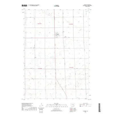
2017 Map of Stickney
USGS Topo · Published 2017About this map
Stickney serves as the central hub of this Aurora County landscape, situated amidst a highly structured grid of section lines and rural roads. The town's layout is defined by Main St, N 1st Ave, and N 3rd Ave, reflecting the systematic development of the South Dakota plains. Outside the town limits, the geography is marked by numerous small depressions and seasonal wetlands characteristic of the glaciated prairie, with Stickney Lake sitting at the northeastern corner and Enemy Cr winding through the eastern sections. For those researching local history, the map provides precise locations for four distinct burial grounds: Saint Mary Cem, Silver Ridge Cem, Saint Paul Cem, and Old Saint Paul Cem, which together trace the denominational and social development of this agricultural community.
Find a feature on this map
25 named features on this map. Tap any name to fly to it.
Don’t see what you’re looking for? This feature index may not catch every label — zoom into the map to look around manually.
Map Details
Editions of this 2017 Stickney Map
This is the sole edition of this map. No revisions or reprints were ever made.
Other maps of this area

1899 · Mitchell
USGS Topo · 1:125,000

1955 · Mitchell
USGS Topo · 1:250,000

1959 · Mitchell
USGS Topo · 1:250,000

1979 · New Holland
USGS Topo · 1:24,000

1979 · Crystal Lake
USGS Topo · 1:24,000

1979 · Aurora Center
USGS Topo · 1:24,000

1980 · Stickney
USGS Topo · 1:24,000

1980 · Corsica Lake
USGS Topo · 1:24,000

1980 · Old Stickney Lake
USGS Topo · 1:24,000

1980 · Mount Vernon
USGS Topo · 1:24,000