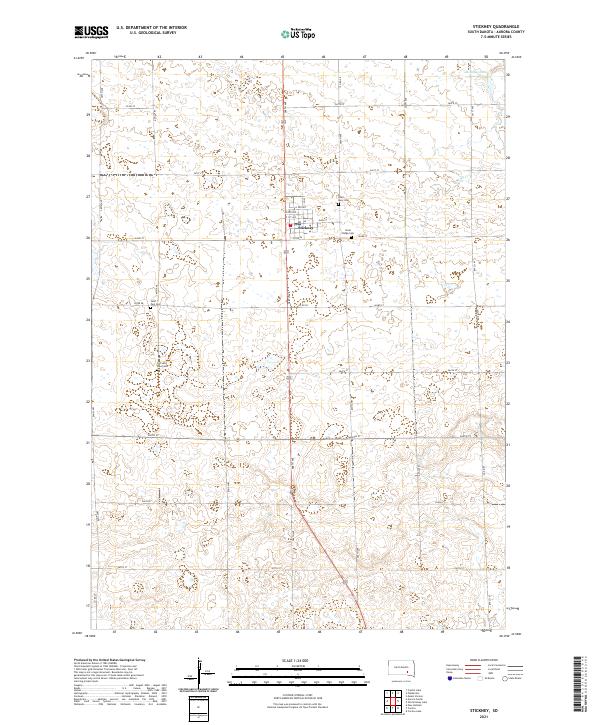
2021 Map of Stickney
USGS Topo · Published 2021About this map
Stickney sits at the center of this Aurora County landscape, serving as a primary hub for the surrounding agricultural prairie. The town's grid is clearly defined by streets like Main St and N 1st Ave, reflecting the methodical settlement patterns of the Great Plains. The map reveals a high concentration of burial sites relative to the population center, including Saint Mary Cem and Silver Ridge Cem to the east, and both the Saint Paul Cem and Old Saint Paul Cem to the southwest. These sites, along with the local Po, provide essential touchpoints for genealogists tracing family histories in the region. Outside of the residential core, the topography is shaped by water features like Stickney Lake in the northeast and the winding path of Enemy Cr, while a strict section-line road network of avenues and streets facilitates travel across the township lines of t102n r64w and t102n r63w.
Find a feature on this map
37 named features on this map. Tap any name to fly to it.
Don’t see what you’re looking for? This feature index may not catch every label — zoom into the map to look around manually.
Map Details
Editions of this 2021 Stickney Map
This is the sole edition of this map. No revisions or reprints were ever made.
Other maps of this area

1899 · Mitchell
USGS Topo · 1:125,000

1955 · Mitchell
USGS Topo · 1:250,000

1959 · Mitchell
USGS Topo · 1:250,000

1979 · New Holland
USGS Topo · 1:24,000

1979 · Crystal Lake
USGS Topo · 1:24,000

1979 · Aurora Center
USGS Topo · 1:24,000

1980 · Stickney
USGS Topo · 1:24,000

1980 · Corsica Lake
USGS Topo · 1:24,000

1980 · Old Stickney Lake
USGS Topo · 1:24,000

1980 · Mount Vernon
USGS Topo · 1:24,000