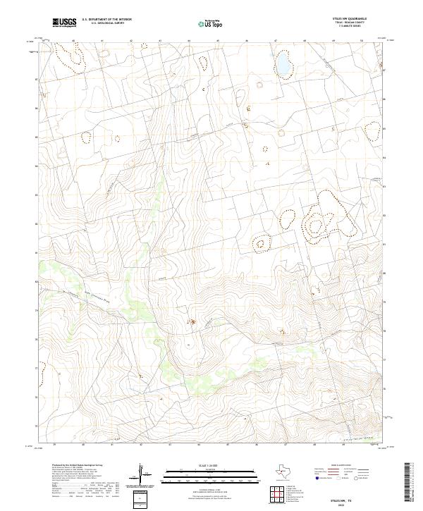
2022 Map of Stiles NW
USGS Topo · Published 2022About this map
High Lonesome Draw and Centralia Draw define the drainage patterns of this West Texas landscape in Reagan County. The terrain is crisscrossed by a network of ranch and mineral roads, reflecting the region's historical ties to both large-scale ranching and the petroleum industry. Notable thoroughfares such as Southland Royalty Rd and Ham Ranch Rd indicate the property names and commercial interests that have shaped the land. Other local routes like Aldwell Rich Rd, Strube Rd, and Hartgrove Rd provide access to the expansive tracts between these draws. This USGS survey presents the contemporary layout of these remote corridors and the subtle topographic shifts characteristic of the Edwards Plateau region.
Find a feature on this map
13 named features on this map. Tap any name to fly to it.
Don’t see what you’re looking for? This feature index may not catch every label — zoom into the map to look around manually.
Map Details
Editions of this 2022 Stiles NW Map
This is the sole edition of this map. No revisions or reprints were ever made.
Other maps of this area

1928 · Rankin
USGS Topo · 1:125,000

1954 · San Angelo
USGS Topo · 1:250,000

1958 · San Angelo
USGS Topo · 1:250,000

1965 · San Angelo
USGS Topo · 1:250,000

1968 · Midkiff SE
USGS Topo · 1:24,000

1970 · Sevenmile Corner NE
USGS Topo · 1:24,000

1970 · Stiles NW
USGS Topo · 1:24,000

1970 · Sevenmile Corner SE
USGS Topo · 1:24,000

1970 · Garrison Draw
USGS Topo · 1:24,000

1970 · Gardener Draw
USGS Topo · 1:24,000