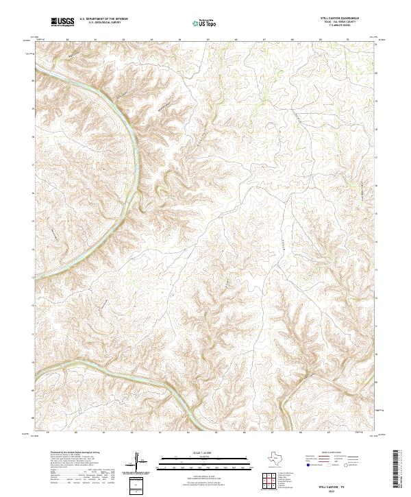
2022 Map of Still Canyon
USGS Topo · Published 2022About this map
The Pecos River cuts a deep course through this segment of Val Verde County, defining a complex landscape of drainage systems and high plateaus. The topography is dominated by an intricate network of steep-walled canyons that feed into the river valley, including Still Canyon, Boyd Canyon, and Zixto Canyon. This 2022 survey illustrates the high desert terrain where narrow, winding tracks like Blue Hills Rd provide the primary access through the upland reaches. Smaller tributaries such as Wildcat Canyon and Moose Canyon further segment the land, creating a repetitive pattern of ridges and draws characteristic of this Trans-Pecos region. The map captures the area's essential character as a place defined by its hydrology and the sheer verticality of the canyon walls that separate the riverbed from the surrounding plains.
Find a feature on this map
11 named features on this map. Tap any name to fly to it.
Don’t see what you’re looking for? This feature index may not catch every label — zoom into the map to look around manually.
Map Details
Editions of this 2022 Still Canyon Map
This is the sole edition of this map. No revisions or reprints were ever made.
Other maps of this area

1943 · Langtry
USGS Topo · 1:62,500

1943 · Shumla
USGS Topo · 1:62,500

1954 · Sonora
USGS Topo · 1:250,000

1958 · Sonora
USGS Topo · 1:250,000

1958 · Del Rio
USGS Topo · 1:250,000

1964 · Del Rio
USGS Topo · 1:250,000

1970 · Everett Canyon
USGS Topo · 1:24,000

1970 · Little Fielder Draw
USGS Topo · 1:24,000

1970 · Blue Hills
USGS Topo · 1:24,000

1973 · Langtry
USGS Topo · 1:24,000