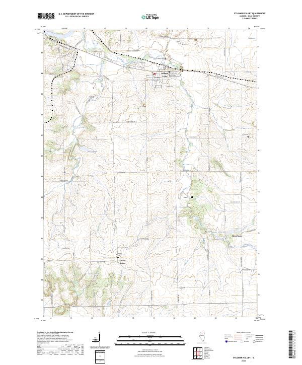
2024 Map of Stillman Valley
USGS Topo · Published 2024About this map
Stillman's Run Battlefield Memorial and Cem anchors the northern village of Stillman Valley, commemorating the first major engagement of the Black Hawk War. This landscape in Ogle County is defined by the drainage of Stillman Creek and Black Walnut Creek as they move toward the Rock River in the northwest corner. The settlement pattern remains largely rural, concentrated around intersections like Paynes Point and White Rock. Genealogists will find a high density of burial sites across the township, including Stillman Valley Cem, Mount Pleasant Cem, and Beach Cem. Modern water features such as Walnut Pond, Hidden Valley Lake, and Traina Pond dot the agricultural terrain, reflecting contemporary land use alongside historical landmarks like the Emmanuel Lutheran Cem.
Find a feature on this map
70 named features on this map. Tap any name to fly to it.
Don’t see what you’re looking for? This feature index may not catch every label — zoom into the map to look around manually.
Map Details
Editions of this 2024 Stillman Valley Map
This is the sole edition of this map. No revisions or reprints were ever made.
Other maps of this area

1917 · Kings
USGS Topo · 1:62,500

1918 · Dixon
USGS Topo · 1:62,500

1918 · Kings
USGS Topo · 1:62,500

1922 · Oregon
USGS Topo · 1:62,500

1924 · Oregon
USGS Topo · 1:62,500

1949 · Camp Grant
USGS Topo · 1:24,000

1950 · Dixon
USGS Topo · 1:62,500

1952 · Rochelle
USGS Topo · 1:62,500

1954 · Rockford
USGS Topo · 1:250,000

1955 · Rockford
USGS Topo · 1:250,000