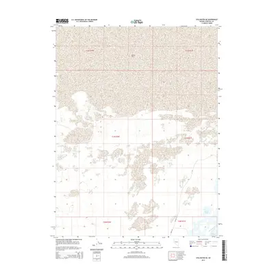
2014 Map of Stillwater NE
USGS Topo · Published 2014About this map
Carson Sink dominates the northern reaches of this high-desert landscape in Churchill County, representing a terminal drainage point for the Carson River where water evaporates in the arid Nevada sun. The southern portion of the quadrangle reveals a complex network of managed water features and wetlands, including Willow Lake and North Lead Lake. The presence of the Lead Bypass Canal indicates human intervention in the local hydrology, likely for agricultural or wildlife management purposes. This 2014 survey documents the late-twentieth-century road system, with simple arteries like Westside Rd and North Rd providing the primary access through the desert flats. The map is heavily defined by the Public Land Survey System, showing the grid boundaries for T22N, T21N, and T20N across ranges R30E and R31E.
Find a feature on this map
13 named features on this map. Tap any name to fly to it.
Don’t see what you’re looking for? This feature index may not catch every label — zoom into the map to look around manually.
Map Details
Editions of this 2014 Stillwater NE Map
This is the sole edition of this map. No revisions or reprints were ever made.
Other maps of this area

1908 · Carson Sink
USGS Topo · 1:250,000

1910 · Carson Sink
USGS Topo · 1:250,000

1950 · Stillwater
USGS Topo · 1:62,500

1951 · Carson Sink
USGS Topo · 1:62,500

1957 · Reno
USGS Topo · 1:250,000

1959 · Reno
USGS Topo · 1:250,000

1960 · Reno
USGS Topo · 1:250,000
1969 · Lone Rock SW
USGS Topo · 1:24,000

1969 · Pintail Bay
USGS Topo · 1:24,000

1969 · Foxtail Lake
USGS Topo · 1:24,000