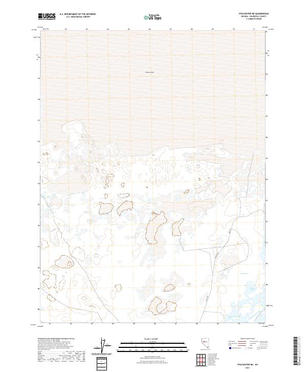
2021 Map of Stillwater NE
USGS Topo · Published 2021About this map
The vast expanse of the Carson Sink dominates the northern half of this landscape in Churchill County. This basin represents the terminus of the Carson River, where water traditionally gathered and evaporated before modern irrigation diverted much of the flow. In the southern portion of the quadrangle, a more complex network of wetlands and water management features appears. Features such as West Marsh and Willow Lake indicate the area's importance as a terminal wetland habitat. The presence of Millens Channel and the Lead Bypass Canal highlights the systematic engineering of water throughout this arid region. Two primary rural routes, North Rd and Westside Rd, provide the only significant terrestrial access points through the marshy terrain, following the section lines of the Public Land Survey System through townships T21N R31E and T20N R31E.
Find a feature on this map
12 named features on this map. Tap any name to fly to it.
Don’t see what you’re looking for? This feature index may not catch every label — zoom into the map to look around manually.
Map Details
Editions of this 2021 Stillwater NE Map
This is the sole edition of this map. No revisions or reprints were ever made.
Other maps of this area

1908 · Carson Sink
USGS Topo · 1:250,000

1910 · Carson Sink
USGS Topo · 1:250,000

1950 · Stillwater
USGS Topo · 1:62,500

1951 · Carson Sink
USGS Topo · 1:62,500

1957 · Reno
USGS Topo · 1:250,000

1959 · Reno
USGS Topo · 1:250,000

1960 · Reno
USGS Topo · 1:250,000
1969 · Lone Rock SW
USGS Topo · 1:24,000

1969 · Pintail Bay
USGS Topo · 1:24,000

1969 · Foxtail Lake
USGS Topo · 1:24,000