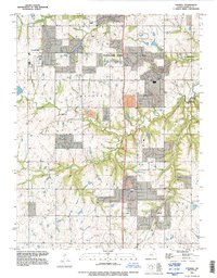
1991 Map of Stilwell
USGS Topo · Published 1995About this map
Stilwell and the surrounding townships of Oxford and Aubry anchor this mid-1990s view of southern Johnson County as suburban expansion begins to blend with established farming communities. The survey detail highlights several distinct nodes of settlement including Morse, Stanley, and Aubry, alongside the eastern fringes of Olathe and Overland Park. The landscape is defined by the drainage systems of the Blue River and its many tributaries, such as Tomahawk Creek and Wolf Creek, which create the undulating terrain typical of this part of Kansas. Local heritage is preserved in landmarks like the Pleasant Valley Cem, while the industrial footprint of the era is represented by a Quarry and a local Pit. The map captures a specific transition period when rural road networks were increasingly serving growing residential corridors near Leawood and Redel.
Find a feature on this map
20 named features on this map. Tap any name to fly to it.
Don’t see what you’re looking for? This feature index may not catch every label — zoom into the map to look around manually.
Map Details
Editions of this 1991 Stilwell Map
This is the sole edition of this map. No revisions or reprints were ever made.
Other maps of this area

1887 · Olathe
USGS Topo · 1:125,000

1893 · Olathe
USGS Topo · 1:125,000

1934 · Grandview
USGS Topo · 1:24,000

1935 · Olathe
USGS Topo · 1:24,000

1935 · Lenexa
USGS Topo · 1:24,000

1939 · Grandview
USGS Topo · 1:31,680

1943 · Lenexa
USGS Topo · 1:31,680

1943 · Olathe
USGS Topo · 1:31,680

1947 · Lawrence
USGS Topo · 1:250,000

1950 · Lawrence
USGS Topo · 1:250,000