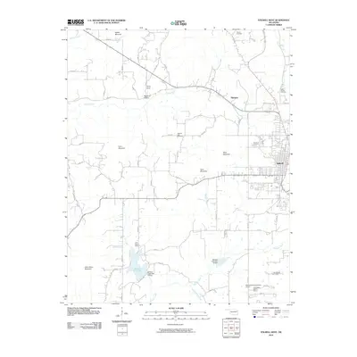
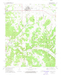
2010 Map of Stilwell West
USGS Topo · Published 2010About this map
Stilwell anchors the eastern edge of this Oklahoma landscape, serving as a gateway to a terrain defined by the foothills of the Ozarks. The area is characterized by several prominent peaks, including Gittin Down Mountain, Goat Mountain, and Coon Mountain, which dictate the winding paths of rural roads and the flow of local waterways. Water management is a visible priority here, evidenced by the Stilwell City Lake and flood control structures like Sallisaw Creek Site 18 Dam and Sallisaw Creek Site 19 Dam along Sallisaw Creek.
Find a feature on this map
62 named features on this map. Tap any name to fly to it.
Don’t see what you’re looking for? This feature index may not catch every label — zoom into the map to look around manually.
Map Details
Editions of this 2010 Stilwell West Map
This is the sole edition of this map. No revisions or reprints were ever made.
Other maps of this area

1898 · Tahlequah
USGS Topo · 1:125,000

1901 · Tahlequah
USGS Topo · 1:125,000

1905 · Tahlequah
USGS Topo · 1:125,000

1946 · Fort Smith
USGS Topo · 1:250,000

1965 · Fort Smith
USGS Topo · 1:250,000

1967 · Fort Smith
USGS Topo · 1:250,000
1972 · Christie
USGS Topo · 1:24,000
1972 · Stilwell West
USGS Topo · 1:24,000
1972 · Tailholt
USGS Topo · 1:24,000
1972 · Westville
USGS Topo · 1:24,000