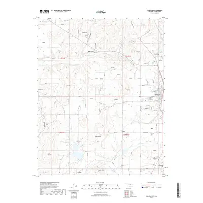
2019 Map of Stilwell West
USGS Topo · Published 2019About this map
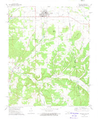
Stilwell serves as the regional anchor on the eastern edge of this landscape, where the residential grid meets the rugged foothills of the Ozarks. The terrain is defined by a series of prominent peaks and ridges, including Goat Mtn, Coon Mtn, and Doublehead Mtn, which separate the various creek valleys. Numerous small settlements and rural communities are scattered throughout the hills, connected by a network of county roads. Genealogical interest is particularly high here, with several family and community burial grounds documented, such as Mulberry Tree Cem, Pilgrims Rest Cem, and Doublehead Cem. The drainage patterns are dominated by the winding course of Sallisaw Cr and Caney Cr, which carve through the hollows like Mulberry Hollow and Smith Hollow.
Find a feature on this map
72 named features on this map. Tap any name to fly to it.
Don’t see what you’re looking for? This feature index may not catch every label — zoom into the map to look around manually.
Map Details
Editions of this 2019 Stilwell West Map
This is the sole edition of this map. No revisions or reprints were ever made.
Other maps of this area

1898 · Tahlequah
USGS Topo · 1:125,000

1901 · Tahlequah
USGS Topo · 1:125,000

1905 · Tahlequah
USGS Topo · 1:125,000

1946 · Fort Smith
USGS Topo · 1:250,000

1965 · Fort Smith
USGS Topo · 1:250,000

1967 · Fort Smith
USGS Topo · 1:250,000
1972 · Christie
USGS Topo · 1:24,000
1972 · Stilwell West
USGS Topo · 1:24,000
1972 · Tailholt
USGS Topo · 1:24,000
1972 · Westville
USGS Topo · 1:24,000