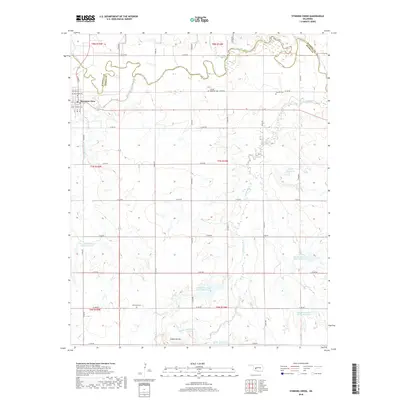
2018 Map of Stinking Creek
USGS Topo · Published 2018About this map
The town of Mountain View sits at the western edge of this landscape, situated along the Washita River where it forms the boundary between Washita County and Kiowa County. The surrounding terrain is defined by a series of north-south and east-west roads, such as N2400 Rd and E 1350 Rd, which partition the agricultural and ranching land. The southern portion of the map is punctuated by more varied topography, including Zodletone Mtn and the upper reaches of Saddle Mountain Cr.
Find a feature on this map
46 named features on this map. Tap any name to fly to it.
Don’t see what you’re looking for? This feature index may not catch every label — zoom into the map to look around manually.
Map Details
Editions of this 2018 Stinking Creek Map
This is the sole edition of this map. No revisions or reprints were ever made.
Other maps of this area

1949 · Cooperton
USGS Topo · 1:62,500

1950 · Saddle Mountain
USGS Topo · 1:62,500

1955 · Lawton
USGS Topo · 1:250,000

1955 · Clinton
USGS Topo · 1:250,000

1956 · Alden
USGS Topo · 1:24,000

1956 · Bally Mountain
USGS Topo · 1:24,000

1956 · Unap Mountain
USGS Topo · 1:24,000

1956 · Saddle Mountain
USGS Topo · 1:62,500

1956 · Cooperton
USGS Topo · 1:62,500

1957 · Clinton
USGS Topo · 1:250,000