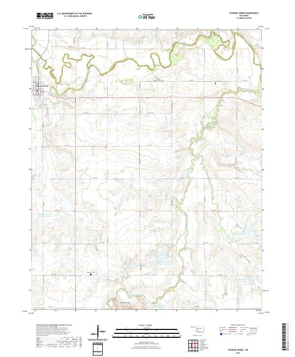
2022 Map of Stinking Creek
USGS Topo · Published 2022About this map
Mountain View sits at the northwestern edge of this landscape, where the Washita River meanders across the border of Washita and Kiowa Counties. The terrain is defined by a sophisticated system of flood control and water management, evidenced by numerous named impoundments including the Saddle Mountain Site 1 Reservoir and Rainy Mountain Cr Site 3 Reservoir. This network of reservoirs supports the agricultural drainage basins of Rainy Mountain Creek and Stinking Creek.
Find a feature on this map
45 named features on this map. Tap any name to fly to it.
Don’t see what you’re looking for? This feature index may not catch every label — zoom into the map to look around manually.
Map Details
Editions of this 2022 Stinking Creek Map
This is the sole edition of this map. No revisions or reprints were ever made.
Other maps of this area

1949 · Cooperton
USGS Topo · 1:62,500

1950 · Saddle Mountain
USGS Topo · 1:62,500

1955 · Lawton
USGS Topo · 1:250,000

1955 · Clinton
USGS Topo · 1:250,000

1956 · Alden
USGS Topo · 1:24,000

1956 · Bally Mountain
USGS Topo · 1:24,000

1956 · Unap Mountain
USGS Topo · 1:24,000

1956 · Saddle Mountain
USGS Topo · 1:62,500

1956 · Cooperton
USGS Topo · 1:62,500

1957 · Clinton
USGS Topo · 1:250,000