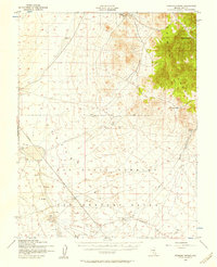
1952 Map of Stinking Spring
USGS Topo · Published 1958About this map
The Kawich Range dominates the eastern landscape of this Nevada survey, providing a sharp contrast to the sprawling military installations to the west. This mid-century record documents a transition from pioneer ranching and mineral exploration to Cold War defense testing. The high country near Longstreets Ranch and Silverbow Springs represents the region's earlier character, while the vast southern portion is designated as the Las Vegas Bombing and Gunnery Range. Within this Restricted zone, the map identifies specific military infrastructure including a Landing Field, various Target points, and a Bunker. Between these eras of use lies the Golden Arrow Mining Area, tucked against the hills, marking the enduring search for resources in the high desert. The Mt Diablo Base Line serves as the primary latitudinal reference across this sparsely settled terrain.
Find a feature on this map
14 named features on this map. Tap any name to fly to it.
Don’t see what you’re looking for? This feature index may not catch every label — zoom into the map to look around manually.
Map Details
Editions of this 1952 Stinking Spring Map
3 editions found
Other maps of this area

1908 · Kawich
USGS Topo · 1:250,000

1942 · Cactus Range
USGS Topo · 1:125,000

1942 · Reveille Peak
USGS Topo · 1:125,000

1952 · Stinking Spring
USGS Topo · 1:62,500

1952 · Mellan
USGS Topo · 1:62,500

1952 · Kawich Peak
USGS Topo · 1:62,500

1952 · Cactus Spring
USGS Topo · 1:62,500

1952 · Quartzite Mtn
USGS Topo · 1:62,500

1952 · Cactus Peak
USGS Topo · 1:62,500

1954 · Goldfield
USGS Topo · 1:250,000