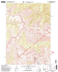
1991 Map of Stinkingwater Peak
USGS Topo · Published 1997About this map
The high-altitude drainage of the Lamar River and Hoodoo Creek dominates this wilderness terrain, where the northern edge of the North Absaroka Wilderness meets Yellowstone National Park. This 1991 revision, based on 1985 aerial photography, documents the rugged transition between the Hoodoo Basin and the volcanic spires of Hoodoo Peak. The map highlights a history of mineral exploration concentrated in the Hughes Basin area, where several distinct mining claims are located.
Find a feature on this map
38 named features on this map. Tap any name to fly to it.
Don’t see what you’re looking for? This feature index may not catch every label — zoom into the map to look around manually.
Map Details
Editions of this 1991 Stinkingwater Peak Map
2 editions found
Other maps of this area

1896 · Crandall Creek
USGS Topo · 1:125,000

1899 · Crandall
USGS Topo · 1:125,000

1955 · Cody
USGS Topo · 1:250,000

1956 · Sunlight Peak
USGS Topo · 1:62,500

1956 · Beartooth Butte
USGS Topo · 1:62,500

1956 · Pilot Peak
USGS Topo · 1:62,500

1956 · Dead Indian Peak
USGS Topo · 1:62,500

1958 · Cody
USGS Topo · 1:250,000

1962 · Cody
USGS Topo · 1:250,000

1980 · Cody
USGS Topo · 1:100,000