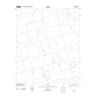
2012 Map of Stith
USGS Topo · Published 2012About this map
Stith serves as the central focal point for this rural landscape in Jones County, defined by a deliberate network of farm-to-market roads and energy extraction sites. The geography is marked by the presence of the Stith Oil Field and the Wimberly Oil Field, illustrating the area's continued integration into the Texas petroleum economy. Water drainage is dominated by the meandering course of Bitter Cr, which flows toward the Clear Fork in the north, while Mulberry Cr and Bull Wagon Cr define the southeastern terrain. Local transit relies on a grid of county roads and key routes like Farm-To-Market Road 1235 and Ranch Road 1235. The landscape is largely agricultural and industrial, with the New York Hls providing some topographic variation in the south. This survey documents the intersection of traditional land use and the modern infrastructure required for mid-century and later oil production.
Find a feature on this map
50 named features on this map. Tap any name to fly to it.
Don’t see what you’re looking for? This feature index may not catch every label — zoom into the map to look around manually.
Map Details
Editions of this 2012 Stith Map
This is the sole edition of this map. No revisions or reprints were ever made.
Other maps of this area

1890 · Abilene
USGS Topo · 1:125,000

1891 · Anson
USGS Topo · 1:125,000

1892 · Abilene
USGS Topo · 1:125,000

1893 · Roby
USGS Topo · 1:125,000

1893 · Anson
USGS Topo · 1:125,000

1893 · Sweetwater
USGS Topo · 1:125,000

1954 · Big Spring
USGS Topo · 1:250,000

1954 · Abilene
USGS Topo · 1:250,000

1957 · Hawley
USGS Topo · 1:62,500

1957 · Merkel
USGS Topo · 1:62,500