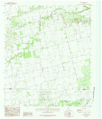
1984 Map of Stith
USGS Topo · Published 1984About this map
Stith serves as the central hub of this West Texas landscape, positioned just north of the Jones Co Taylor Co boundary line. In the late 1970s and early 1980s, the region was defined by a sparse ranching and agricultural network, where drainage systems like Bitter Creek and Mulberry Creek carved significant paths through the terrain. The presence of a local Cem near the settlement provides a localized point of interest for genealogists tracking family roots in this rural corridor. Human infrastructure is represented by a prominent Pipeline that traverses the southern half of the map, cutting across the natural flow of Wagon Creek and Bull Creek. The survey reflects a transitional period in the Texas plains where traditional land use met modern utility expansion, all while maintaining the quiet character of the small crossroads community.
Find a feature on this map
8 named features on this map. Tap any name to fly to it.
Don’t see what you’re looking for? This feature index may not catch every label — zoom into the map to look around manually.
Map Details
Editions of this 1984 Stith Map
This is the sole edition of this map. No revisions or reprints were ever made.
Other maps of this area

1890 · Abilene
USGS Topo · 1:125,000

1891 · Anson
USGS Topo · 1:125,000

1892 · Abilene
USGS Topo · 1:125,000

1893 · Roby
USGS Topo · 1:125,000

1893 · Anson
USGS Topo · 1:125,000

1893 · Sweetwater
USGS Topo · 1:125,000

1954 · Big Spring
USGS Topo · 1:250,000

1954 · Abilene
USGS Topo · 1:250,000

1957 · Hawley
USGS Topo · 1:62,500

1957 · Merkel
USGS Topo · 1:62,500