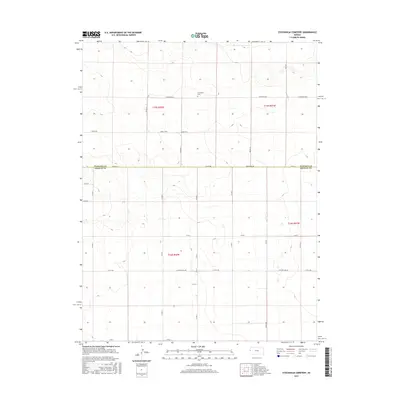
2015 Map of Stockholm Cemetery
USGS Topo · Published 2015About this map
Stockholm Cem stands as a lonely landmark in this section of the High Plains, situated just north of the border between Wallace Co and Greeley Co. The landscape is defined by the rigid grid of the Public Land Survey System, with township lines for T15S and T16S intersecting the range lines of R42W and R41W. This 2015 survey reveals a sparse, high-altitude environment where the infrastructure is almost entirely dedicated to a network of section-line roads. Descriptive local names like Bumpy Rd, Crosswind Rd, and Thirteen Mile Rd provide a sense of the driving conditions and scale of these expansive western Kansas townships. The lack of concentrated settlements or industrial footprints emphasizes the agricultural and cemetery-centered nature of this specific geographic quadrangle.
Find a feature on this map
30 named features on this map. Tap any name to fly to it.
Don’t see what you’re looking for? This feature index may not catch every label — zoom into the map to look around manually.
Map Details
Editions of this 2015 Stockholm Cemetery Map
This is the sole edition of this map. No revisions or reprints were ever made.
Other maps of this area

1892 · Cheyenne Wells
USGS Topo · 1:125,000

1894 · Cheyenne Wells
USGS Topo · 1:125,000

1954 · Lamar
USGS Topo · 1:250,000

1955 · Scott City
USGS Topo · 1:250,000

1958 · Lamar
USGS Topo · 1:250,000

1958 · Scott City
USGS Topo · 1:250,000

1959 · Weskan
USGS Topo · 1:62,500

1968 · Sharon Springs 3 NE
USGS Topo · 1:24,000

1968 · Sharon Springs 3 NW
USGS Topo · 1:24,000

1969 · Arapahoe SE
USGS Topo · 1:24,000