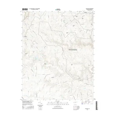
2016 Map of Stockton
USGS Topo · Published 2016About this map
Stockton lies along the transition between the rolling plateaus of Fentress County and the deeply incised gorges of the Big South Fork National River and Recreation Area. This landscape is defined by its complex drainage network, where waters like Stone Coal Br and Mill Cr flow toward the dramatic geology of The Narrows. The map reveals a dispersed settlement pattern centered on narrow ridge-tops and small hollows, with landmarks such as Slipshuck Ridge and Tar Kiln Ridge dictating the path of local roads.
Find a feature on this map
100 named features on this map. Tap any name to fly to it.
Don’t see what you’re looking for? This feature index may not catch every label — zoom into the map to look around manually.
Map Details
Editions of this 2016 Stockton Map
This is the sole edition of this map. No revisions or reprints were ever made.
Other maps of this area

1895 · Wartburg
USGS Topo · 1:125,000

1896 · Wartburg
USGS Topo · 1:125,000

1934 · Barthell
USGS Topo · 1:62,500

1934 · Pall Mall
USGS Topo · 1:62,500

1952 · Honey Creek
USGS Topo · 1:24,000

1952 · Rugby
USGS Topo · 1:24,000

1954 · Stockton
USGS Topo · 1:24,000

1954 · Burrville
USGS Topo · 1:24,000

1954 · Jamestown
USGS Topo · 1:24,000

1954 · Grimsley
USGS Topo · 1:24,000